 vesseltracker.com
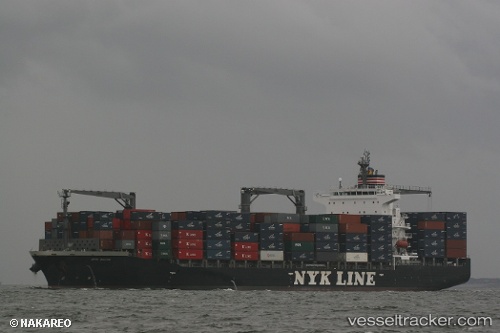
 NYK SILVIA
Current Status
Where is the vessel?
NYK SILVIA is currently in Near Lazaro Cardenas, based on AIS data received about 1h ago.
Latest AIS update:
Current position: 17.97615° N, 102.17274° W (Near Lazaro Cardenas)
Average speed (last 7 days): Loading…
Average speed (last 30 days): Loading…
Vessel profile: NYK SILVIA is a Container Ship with dimensions 210m x 32m.
This page combines live AIS, route history, probable destination signals, nearby traffic, and port activity for practical vessel monitoring.
The current position of vessel NYK SILVIA is 17.97615 lat / -102.17274 lng. Updated: 2026-04-08 23:33:13 UTCNearest reference points:
- Near Lazaro Cardenas
- Near Ixtapa/Zihuatanejo
- 43 nm SW of Antunez
Currently sailing under the flag of Marshall Islands ![]()
NYK SILVIA built in 2009 year
Deadweight:
34533 tDetails:
Live Vessel NYK SILVIA Analytics (details, animations, etc.)
Recent AIS points (UTC):
2026-04-08 16:01:42 UTC · 17.86021, -102.25388 · SOG 11.7 kn · COG 91°2026-04-08 18:12:03 UTC · 17.97605, -102.17253 · SOG 0 kn · COG 357°
2026-04-08 19:57:13 UTC · 17.97631, -102.17251 · SOG 0 kn · COG 357°
2026-04-08 23:33:13 UTC · 17.97615, -102.17274 · SOG 0 kn · COG 358°