 vesseltracker.com
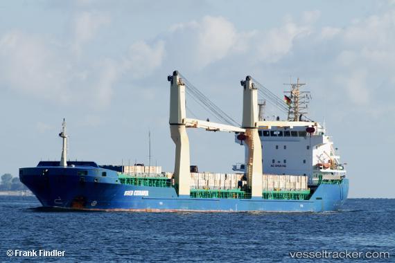
 Breb Cuxhaven
Current Status
Where is the vessel?
Breb Cuxhaven is currently in Near Willebroek, based on AIS data received less than 1h ago.
Latest AIS update:
Current position: 51.07462° N, 4.36321° E (Near Willebroek)
Average speed (last 7 days): Loading…
Average speed (last 30 days): Loading…
Vessel profile: Breb Cuxhaven is a Multi Purpose Carrier with dimensions 108m x 108m.
This page combines live AIS, route history, probable destination signals, nearby traffic, and port activity for practical vessel monitoring.
The current position of vessel Breb Cuxhaven is 51.07462 lat / 4.36321 lng. Updated: 2026-04-18 00:00:27 UTCNearest reference points:
- Near Blaasveld
- Near Klein Willebroek
- Near Kruibeke
Currently sailing under the flag of Portugal ![]()
Breb Cuxhaven built in 2010 year
Deadweight:
7815 tDetails:
Live Vessel Breb Cuxhaven Analytics (details, animations, etc.)
Recent AIS points (UTC):
2026-04-17 17:24:24 UTC · 51.07462, 4.36320 · SOG 0 kn · COG 160°2026-04-17 19:33:27 UTC · 51.07462, 4.36317 · SOG 0 kn · COG 160°
2026-04-17 21:48:34 UTC · 51.07466, 4.36317 · SOG 0 kn · COG 160°
2026-04-18 00:00:27 UTC · 51.07462, 4.36321 · SOG 0 kn · COG 160°