 vesseltracker.com
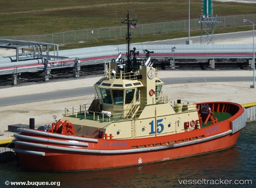
 Sp Amber
Current Status
Where is the vessel?
Sp Amber is currently in Near SABINE PASS, based on AIS data received less than 1h ago.
Latest AIS update:
Current position: 29.74495° N, 93.86950° W (Near SABINE PASS)
Average speed (last 7 days): Loading…
Average speed (last 30 days): Loading…
Vessel profile: Sp Amber is a Tug with dimensions 32m x 14m.
This page combines live AIS, route history, probable destination signals, nearby traffic, and port activity for practical vessel monitoring.
The current position of vessel Sp Amber is 29.74495 lat / -93.86950 lng. Updated: 2026-04-18 15:26:26 UTCNearest reference points:
- Near SABINE PASS
- 10 nm W of Sabine Pass
- Near Atreco
Currently sailing under the flag of USA ![]()
Sp Amber built in 2008 year
Deadweight:
628 tDetails:
Live Vessel Sp Amber Analytics (details, animations, etc.)
Recent AIS points (UTC):
2026-04-18 09:32:48 UTC · 29.74491, -93.86952 · SOG 0 kn · COG 89°2026-04-18 12:01:58 UTC · 29.72914, -93.86785 · SOG 3.8 kn · COG 150°
2026-04-18 13:44:29 UTC · 29.74492, -93.86953 · SOG 0 kn · COG 88°
2026-04-18 15:26:26 UTC · 29.74495, -93.86950 · SOG 0 kn · COG 88°