 vesseltracker.com
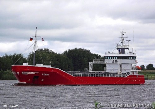
Robijn
Current StatusWhere is the vessel?
Robijn is currently in Near Ringaskiddy, based on AIS data received about 1h ago.
Latest AIS update:
Current position: 51.83324° N, 8.32753° W (Near Ringaskiddy)
Average speed (last 7 days): Loading…
Average speed (last 30 days): Loading…
Vessel profile: Robijn is a General Cargo Ship with dimensions 13m x 90m.
This page combines live AIS, route history, probable destination signals, nearby traffic, and port activity for practical vessel monitoring.
The current position of vessel Robijn is 51.83324 lat / -8.32753 lng. Updated: 2026-04-07 07:52:23 UTCNearest reference points:
- Near Cobn
- Near Covent Garden
- Near HELVICK
Details:
Live Vessel Robijn Analytics (details, animations, etc.)
Recent AIS points (UTC):
2026-04-07 01:37:20 UTC · 51.83322, -8.32755 · SOG 0 kn · COG 322°2026-04-07 04:07:21 UTC · 51.83327, -8.32751 · SOG 0 kn · COG 322°
2026-04-07 05:28:21 UTC · 51.83327, -8.32756 · SOG 0 kn · COG 322°
2026-04-07 07:52:23 UTC · 51.83324, -8.32753 · SOG 0 kn · COG 322°