 vesseltracker.com
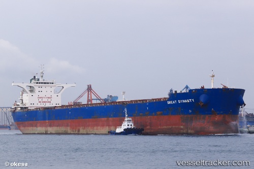
Great Dynasty
Current StatusWhere is the vessel?
Great Dynasty is currently in 44 nm SE of Sabahat, based on AIS data received less than 1h ago.
Latest AIS update:
Current position: 4.66167° N, 119.65333° E (44 nm SE of Sabahat)
Average speed (last 7 days): Loading…
Average speed (last 30 days): Loading…
Vessel profile: Great Dynasty is a Bulk Carrier with dimensions 46m x 295m.
This page combines live AIS, route history, probable destination signals, nearby traffic, and port activity for practical vessel monitoring.
The current position of vessel Great Dynasty is 4.66167 lat / 119.65333 lng. Updated: 2026-04-18 18:11:18 UTCNearest reference points:
- 80 nm SE of Labuan Haji
- 43 nm E of Sibuko Bay
- 66 nm W of Jolo
Details:
Live Vessel Great Dynasty Analytics (details, animations, etc.)
Recent AIS points (UTC):
2026-04-18 11:29:17 UTC · 3.46500, 119.59833 · SOG 10 kn · COG -1°2026-04-18 14:05:17 UTC · 3.90667, 119.61833 · SOG 9 kn · COG -1°
2026-04-18 15:32:19 UTC · 4.15500, 119.62833 · SOG 10 kn · COG -1°
2026-04-18 18:11:18 UTC · 4.66167, 119.65333 · SOG 10 kn · COG -1°