 vesseltracker.com
 NYALA
NYALA
Current Status
Where is the vessel?
NYALA is currently in 27 nm E of Offshore Fujairah, based on AIS data received about 29d ago.
Latest AIS update:
Current position: 25.37255° N, 57.13765° E (27 nm E of Offshore Fujairah)
Average speed (last 7 days): Loading…
Average speed (last 30 days): Loading…
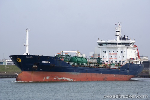
Vessel profile: NYALA is a Oil Products Tanker with dimensions 19m x 126m.
This page combines live AIS, route history, probable destination signals, nearby traffic, and port activity for practical vessel monitoring.
The current position of vessel NYALA is 25.37255 lat / 57.13765 lng. Updated: 2026-03-12 17:27:50 UTCNearest reference points:
- 30 nm NE of Offshore Fujairah
- Near Offshore Fujairah
- 29 nm NE of Offshore Fujairah
Currently sailing under the flag of St.Kitts and Nevis ![]()
NYALA built in 2007 year
Deadweight:
11276 tDetails:
Live Vessel NYALA Analytics (details, animations, etc.)
Recent AIS points (UTC):
2026-03-12 17:27:50 UTC · 25.37255, 57.13765 · SOG 11.3 kn · COG -1°