 vesseltracker.com
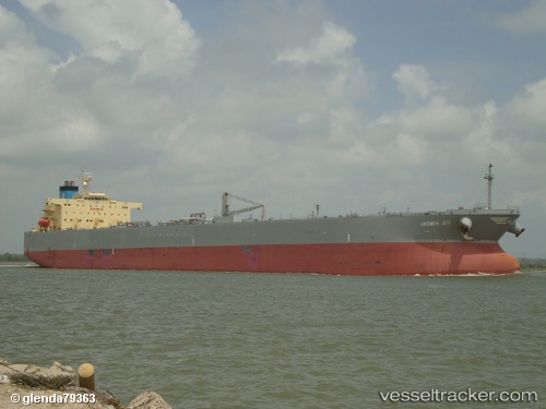
 Jasmin Joy
Current Status
Where is the vessel?
Jasmin Joy is currently in 24 nm W of Sigri Lesvou, based on AIS data received less than 1h ago.
Latest AIS update:
Current position: 39.06658° N, 25.35728° E (24 nm W of Sigri Lesvou)
Average speed (last 7 days): Loading…
Average speed (last 30 days): Loading…
Vessel profile: Jasmin Joy is a Crude Oil Tanker with dimensions 229m x 42m.
This page combines live AIS, route history, probable destination signals, nearby traffic, and port activity for practical vessel monitoring.
The current position of vessel Jasmin Joy is 39.06658 lat / 25.35728 lng. Updated: 2026-04-17 02:42:06 UTCNearest reference points:
- 29 nm SW of Sigri Lesvou
- 28 nm NW of Psará
- 16 nm NW of Sigri Lesvou
Currently sailing under the flag of Bahamas ![]()
Jasmin Joy built in 2009 year
Deadweight:
104604 tDetails:
Live Vessel Jasmin Joy Analytics (details, animations, etc.)
Recent AIS points (UTC):
2026-04-16 19:51:46 UTC · 38.10570, 24.72475 · SOG 9.4 kn · COG 21°2026-04-16 22:22:06 UTC · 38.47327, 24.97113 · SOG 9.6 kn · COG 20°
2026-04-17 00:17:55 UTC · 38.75287, 25.13218 · SOG 9.3 kn · COG 26°
2026-04-17 02:42:06 UTC · 39.06658, 25.35728 · SOG 9.2 kn · COG 23°