 vesseltracker.com
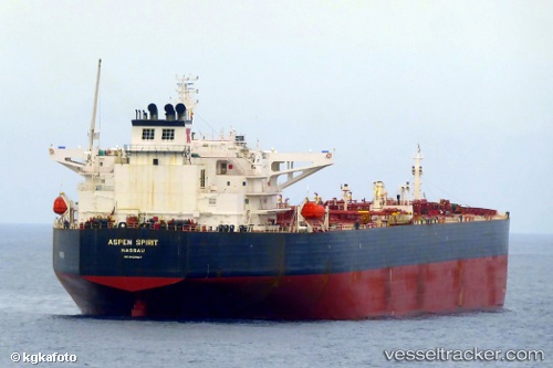
 ADEBOLA ADELINE
Current Status
Where is the vessel?
ADEBOLA ADELINE is currently in 259 nm W of LHOKNGA, based on AIS data received less than 1h ago.
Latest AIS update:
Current position: 6.11500° N, 90.95167° E (259 nm W of LHOKNGA)
Average speed (last 7 days): Loading…
Average speed (last 30 days): Loading…
Vessel profile: ADEBOLA ADELINE is a Crude Oil Tanker with dimensions m x m.
This page combines live AIS, route history, probable destination signals, nearby traffic, and port activity for practical vessel monitoring.
The current position of vessel ADEBOLA ADELINE is 6.11500 lat / 90.95167 lng. Updated: 2026-04-18 18:05:59 UTCNearest reference points:
- 243 nm E of Abakaliki
- 172 nm W of LHOKNGA
- 160 nm W of Sebang
Currently sailing under the flag of Liberia ![]()
Details:
Live Vessel ADEBOLA ADELINE Analytics (details, animations, etc.)
Recent AIS points (UTC):
2026-04-18 12:09:34 UTC · 6.21118, 92.38546 · SOG 15 kn · COG 263°2026-04-18 14:09:31 UTC · 6.16888, 91.89581 · SOG 14.5 kn · COG -1°
2026-04-18 15:59:59 UTC · 6.14667, 91.45167 · SOG 13 kn · COG -1°
2026-04-18 18:05:59 UTC · 6.11500, 90.95167 · SOG 14 kn · COG -1°