 vesseltracker.com
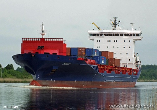
Vessel Pollux IMO: 9429194, MMSI: 305979000 Container Ship
UTC, 47.06582, -53.63418, course: 252, speed: 0.6
UTC, 47.06582, -53.63418, course: 252, speed: 0.6
2026-02-25 12:26:17 UTC, 46.92789, -53.80105, course: 213, speed: 13.7
Live AIS position:
UTC. Near Saint-Marys),
updated 2026-02-25 12:26:17 UTC.
Find the position of the vessel Pollux on the map. The latter are known coordinates and path.
marine traffic ship tracker show on live map
The current position of vessel Pollux is 46.92789 lat / -53.80105 lng. Updated: 2026-02-25 12:26:17 UTCCurrently sailing under the flag of Antigua Barbuda
Pollux built in 2009 year
Deadweight:
14800 tDetails:
Last coordinates of the vessel:
UTC, 47.06552, -53.63393, course: 260, speed: 0.5UTC, 47.06582, -53.63418, course: 252, speed: 0.6
UTC, 47.06582, -53.63418, course: 252, speed: 0.6
2026-02-25 12:26:17 UTC, 46.92789, -53.80105, course: 213, speed: 13.7