 vesseltracker.com
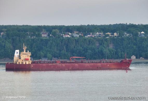
Celsius Randers
Current StatusWhere is the vessel?
Celsius Randers is currently in 322 nm SE of Abakaliki, based on AIS data received less than 1h ago.
Latest AIS update:
Current position: 1.78318° N, 88.85612° E (322 nm SE of Abakaliki)
Average speed (last 7 days): Loading…
Average speed (last 30 days): Loading…
Vessel profile: Celsius Randers is a Chemical Oil Products Tanker with dimensions 32m x 183m.
This page combines live AIS, route history, probable destination signals, nearby traffic, and port activity for practical vessel monitoring.
The current position of vessel Celsius Randers is 1.78318 lat / 88.85612 lng. Updated: 2026-04-18 19:40:39 UTCNearest reference points:
- Open sea, approx. 401 nm off the nearest listed port
- Open sea, approx. 400 nm off the nearest listed port
- Open sea, approx. 402 nm off the nearest listed port
Details:
Live Vessel Celsius Randers Analytics (details, animations, etc.)
Recent AIS points (UTC):
2026-04-18 14:19:59 UTC · 1.02455, 87.99271 · SOG 12.9 kn · COG 46°2026-04-18 15:55:40 UTC · 1.26333, 88.23833 · SOG 13 kn · COG -1°
2026-04-18 18:10:36 UTC · 1.59500, 88.59167 · SOG 13 kn · COG -1°
2026-04-18 19:40:39 UTC · 1.78318, 88.85612 · SOG 13.1 kn · COG 44°