 vesseltracker.com
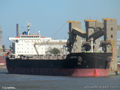
 Sea Empire
Current Status
Where is the vessel?
Sea Empire is currently in 308 nm SW of Hithadhoo Port, based on AIS data received less than 1h ago.
Latest AIS update:
Current position: 3.30941° S, 68.72005° E (308 nm SW of Hithadhoo Port)
Average speed (last 7 days): Loading…
Average speed (last 30 days): Loading…
Vessel profile: Sea Empire is a Bulk Carrier with dimensions 229m x 32m.
This page combines live AIS, route history, probable destination signals, nearby traffic, and port activity for practical vessel monitoring.
The current position of vessel Sea Empire is -3.30941 lat / 68.72005 lng. Updated: 2026-04-03 04:23:07 UTCNearest reference points:
- 222 nm SW of Gan
Currently sailing under the flag of Panama ![]()
Sea Empire built in 2010 year
Deadweight:
79372 tDetails:
Live Vessel Sea Empire Analytics (details, animations, etc.)
Recent AIS points (UTC):
2026-04-02 21:19:47 UTC · -3.93014, 67.42781 · SOG 12.2 kn · COG 63°2026-04-02 23:41:15 UTC · -3.71825, 67.85979 · SOG 12.1 kn · COG 68°
2026-04-03 01:36:45 UTC · -3.56756, 68.22090 · SOG 12 kn · COG 65°
2026-04-03 04:23:07 UTC · -3.30941, 68.72005 · SOG 12.2 kn · COG 65°