 vesseltracker.com
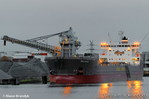
Vessel Beltnes IMO: 9432206, MMSI: 305426000 Self Discharging Bulk Carrier
UTC, 52.57800, 1.73883, course: 183, speed: 0.2
UTC, 52.57800, 1.73883, course: 183, speed: 0.8
2026-02-18 21:49:34 UTC, 52.57800, 1.73883, course: 183, speed: 1.1
Live AIS position:
UTC. Near GREAT YARMOUTH),
updated 2026-02-18 21:49:34 UTC.
Find the position of the vessel Beltnes on the map. The latter are known coordinates and path.
marine traffic ship tracker show on live map
The current position of vessel Beltnes is 52.57800 lat / 1.73883 lng. Updated: 2026-02-18 21:49:34 UTCCurrently sailing under the flag of Antigua Barbuda
Beltnes built in 2009 year
Deadweight:
33173 tDetails:
Last coordinates of the vessel:
UTC, 52.57800, 1.73900, course: 183, speed: 0.3UTC, 52.57800, 1.73883, course: 183, speed: 0.2
UTC, 52.57800, 1.73883, course: 183, speed: 0.8
2026-02-18 21:49:34 UTC, 52.57800, 1.73883, course: 183, speed: 1.1