 vesseltracker.com
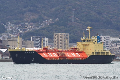
 Shinju Maru No.2
Current Status
Where is the vessel?
Shinju Maru No.2 is currently in Near Komatsushima, based on AIS data received about 1h ago.
Latest AIS update:
Current position: 34.02828° N, 134.62971° E (Near Komatsushima)
Average speed (last 7 days): Loading…
Average speed (last 30 days): Loading…
Vessel profile: Shinju Maru No.2 is a Lng Tanker with dimensions 87m x 87m.
This page combines live AIS, route history, probable destination signals, nearby traffic, and port activity for practical vessel monitoring.
The current position of vessel Shinju Maru No.2 is 34.02828 lat / 134.62971 lng. Updated: 2026-04-18 13:44:37 UTCNearest reference points:
- Near TOKUSHIMA
- Near SHIMOTSU
- Near Awaji
Currently sailing under the flag of Japan ![]()
Shinju Maru No.2 built in 2008 year
Deadweight:
1781 tDetails:
Live Vessel Shinju Maru No.2 Analytics (details, animations, etc.)
Recent AIS points (UTC):
2026-04-18 07:47:41 UTC · 34.02889, 134.62823 · SOG 0 kn · COG 130°2026-04-18 10:08:36 UTC · 34.02907, 134.62859 · SOG 0.1 kn · COG 156°
2026-04-18 11:23:35 UTC · 34.02906, 134.62865 · SOG 0 kn · COG 158°
2026-04-18 13:44:37 UTC · 34.02828, 134.62971 · SOG 0.1 kn · COG 269°