 vesseltracker.com
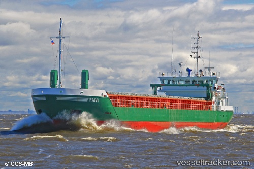
 Paivi
Paivi
Current Status
Where is the vessel?
Paivi is currently in 12 nm NW of Fenit, based on AIS data received less than 1h ago.
Latest AIS update:
Current position: 52.39641° N, 10.12279° W (12 nm NW of Fenit)
Average speed (last 7 days): Loading…
Average speed (last 30 days): Loading…
Vessel profile: Paivi is a General Cargo Ship with dimensions 82m x 12m.
This page combines live AIS, route history, probable destination signals, nearby traffic, and port activity for practical vessel monitoring.
The current position of vessel Paivi is 52.39641 lat / -10.12279 lng. Updated: 2026-03-31 06:03:33 UTCNearest reference points:
- Near Tarbert Island
- Near CASTLETOWN BEARHAVEN
- Near Skull
Currently sailing under the flag of Cyprus ![]()
Paivi built in 2008 year
Deadweight:
3450 tDetails:
Live Vessel Paivi Analytics (details, animations, etc.)
Recent AIS points (UTC):
2026-03-30 23:51:40 UTC · 51.59227, -10.67211 · SOG 9.3 kn · COG 352°2026-03-31 02:16:14 UTC · 51.96812, -10.71154 · SOG 9.4 kn · COG 352°
2026-03-31 03:23:27 UTC · 52.12257, -10.63587 · SOG 10.4 kn · COG 51°
2026-03-31 06:03:33 UTC · 52.39641, -10.12279 · SOG 8.2 kn · COG 49°