 vesseltracker.com
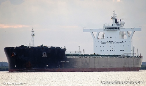
 MARIJEANNIE C
Current Status
Where is the vessel?
MARIJEANNIE C is currently in Near PENGERANG, based on AIS data received about 1d ago.
Latest AIS update:
Current position: 1.30027° N, 104.23808° E (Near PENGERANG)
Average speed (last 7 days): Loading…
Average speed (last 30 days): Loading…
Vessel profile: MARIJEANNIE C is a Bulk Carrier with dimensions m x m.
This page combines live AIS, route history, probable destination signals, nearby traffic, and port activity for practical vessel monitoring.
The current position of vessel MARIJEANNIE C is 1.30027 lat / 104.23808 lng. Updated: 2026-04-10 08:08:45 UTCNearest reference points:
- Near PENGERANG
- Near TANAH MERAH
- Near Tanjung Setapa
Currently sailing under the flag of Malta ![]()
Details:
Live Vessel MARIJEANNIE C Analytics (details, animations, etc.)
Recent AIS points (UTC):
2026-04-10 01:38:56 UTC · 1.57805, 104.73198 · SOG 9.8 kn · COG 268°2026-04-10 04:14:16 UTC · 1.46233, 104.50605 · SOG 7.1 kn · COG 232°
2026-04-10 05:57:06 UTC · 1.36430, 104.38450 · SOG 3.6 kn · COG 229°
2026-04-10 08:08:45 UTC · 1.30027, 104.23808 · SOG 5.8 kn · COG 261°