 vesseltracker.com
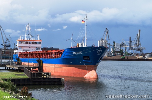
Anmare
Current StatusWhere is the vessel?
Anmare is currently in 34 nm NE of Ryuo, based on AIS data received about 1h ago.
Latest AIS update:
Current position: 36.03727° N, 17.14992° E (34 nm NE of Ryuo)
Average speed (last 7 days): Loading…
Average speed (last 30 days): Loading…
Vessel profile: Anmare is a Multi Purpose Carrier with dimensions 13m x 88m.
This page combines live AIS, route history, probable destination signals, nearby traffic, and port activity for practical vessel monitoring.
The current position of vessel Anmare is 36.03727 lat / 17.14992 lng. Updated: 2026-04-01 09:08:41 UTCNearest reference points:
- 53 nm NE of Ryuo
- 64 nm NE of Ryuo
- 33 nm N of Ryuo
Details:
Live Vessel Anmare Analytics (details, animations, etc.)
Recent AIS points (UTC):
2026-04-01 04:10:40 UTC · 36.03500, 16.17167 · SOG 9 kn · COG -1°2026-04-01 05:07:56 UTC · 36.03500, 16.35667 · SOG 8 kn · COG -1°
2026-04-01 07:38:53 UTC · 36.03833, 16.85500 · SOG 9 kn · COG -1°
2026-04-01 09:08:41 UTC · 36.03727, 17.14992 · SOG 9.5 kn · COG -1°