 vesseltracker.com
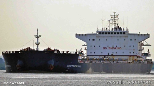
Constantinos G O
Current StatusWhere is the vessel?
Constantinos G O is currently in 62 nm SE of Terempa, based on AIS data received less than 1h ago.
Latest AIS update:
Current position: 2.40500° N, 106.86666° E (62 nm SE of Terempa)
Average speed (last 7 days): Loading…
Average speed (last 30 days): Loading…
Vessel profile: Constantinos G O is a Bulk Carrier with dimensions 37m x 229m.
This page combines live AIS, route history, probable destination signals, nearby traffic, and port activity for practical vessel monitoring.
The current position of vessel Constantinos G O is 2.40500 lat / 106.86666 lng. Updated: 2026-04-16 23:39:42 UTCNearest reference points:
- 45 nm E of Terempa
- 76 nm NE of KIJANG
- 30 nm SW of Belanak Terminal
Details:
Live Vessel Constantinos G O Analytics (details, animations, etc.)
Recent AIS points (UTC):
2026-04-16 16:57:42 UTC · 2.81833, 107.94833 · SOG 9 kn · COG -1°2026-04-16 19:42:42 UTC · 2.65333, 107.51500 · SOG 10 kn · COG -1°
2026-04-16 21:24:45 UTC · 2.54833, 107.23333 · SOG 10 kn · COG -1°
2026-04-16 23:39:42 UTC · 2.40500, 106.86666 · SOG 10 kn · COG -1°