 vesseltracker.com
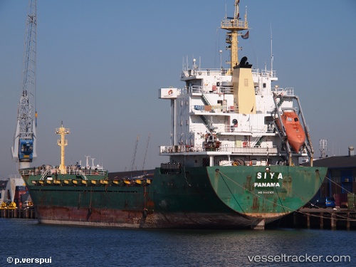
 SIYA
SIYA
Current Status
Where is the vessel?
SIYA is currently in Near Trabzon, based on AIS data received about 2h ago.
Latest AIS update:
Current position: 41.00269° N, 39.74226° E (Near Trabzon)
Average speed (last 7 days): Loading…
Average speed (last 30 days): Loading…
Vessel profile: SIYA is a General Cargo Ship with dimensions 131m x 131m.
This page combines live AIS, route history, probable destination signals, nearby traffic, and port activity for practical vessel monitoring.
The current position of vessel SIYA is 41.00269 lat / 39.74226 lng. Updated: 2026-04-07 07:22:44 UTCNearest reference points:
- Near Rize
- 31 nm N of Pazar
- Near Hopa
Currently sailing under the flag of Liberia ![]()
SIYA built in 2007 year
Deadweight:
10475 tDetails:
Live Vessel SIYA Analytics (details, animations, etc.)
Recent AIS points (UTC):
2026-04-06 23:54:58 UTC · 41.00167, 39.74167 · SOG 0 kn · COG -1°2026-04-07 03:49:39 UTC · 41.00273, 39.74225 · SOG 0 kn · COG 287°
2026-04-07 05:37:39 UTC · 41.00273, 39.74232 · SOG 0 kn · COG 287°
2026-04-07 07:22:44 UTC · 41.00269, 39.74226 · SOG 0 kn · COG 288°