 vesseltracker.com
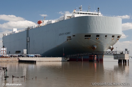
Adriatic Highway
Current StatusWhere is the vessel?
Adriatic Highway is currently in Near PYEONGTAEK, based on AIS data received about 2h ago.
Latest AIS update:
Current position: 36.97468° N, 126.83010° E (Near PYEONGTAEK)
Average speed (last 7 days): Loading…
Average speed (last 30 days): Loading…
Vessel profile: Adriatic Highway is a Vehicles Carrier with dimensions 32m x 199m.
This page combines live AIS, route history, probable destination signals, nearby traffic, and port activity for practical vessel monitoring.
The current position of vessel Adriatic Highway is 36.97468 lat / 126.83010 lng. Updated: 2026-03-27 21:45:21 UTCNearest reference points:
- Near PYEONGTAEK
- Near Dangjin
- Near Incheon
Details:
Live Vessel Adriatic Highway Analytics (details, animations, etc.)
Recent AIS points (UTC):
2026-03-27 15:39:25 UTC · 36.97468, 126.83008 · SOG 0.1 kn · COG -1°2026-03-27 17:44:58 UTC · 36.97467, 126.83010 · SOG 0 kn · COG -1°
2026-03-27 19:42:19 UTC · 36.97467, 126.83008 · SOG 0 kn · COG -1°
2026-03-27 21:45:21 UTC · 36.97468, 126.83010 · SOG 0 kn · COG -1°