 vesseltracker.com
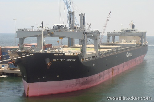
Macuru Arrow
Current StatusWhere is the vessel?
Macuru Arrow is currently in 244 nm E of Sapiranga, based on AIS data received about 2h ago.
Latest AIS update:
Current position: 29.73167° S, 20.41667° W (244 nm E of Sapiranga)
Average speed (last 7 days): Loading…
Average speed (last 30 days): Loading…
Vessel profile: Macuru Arrow is a Bulk Carrier with dimensions 32m x 225m.
This page combines live AIS, route history, probable destination signals, nearby traffic, and port activity for practical vessel monitoring.
The current position of vessel Macuru Arrow is -29.73167 lat / -20.41667 lng. Updated: 2026-03-28 20:15:57 UTCDetails:
Live Vessel Macuru Arrow Analytics (details, animations, etc.)
Recent AIS points (UTC):
2026-03-28 14:08:27 UTC · -29.83304, -18.82507 · SOG 13.6 kn · COG 274°2026-03-28 16:15:57 UTC · -29.79500, -19.37833 · SOG 13 kn · COG -1°
2026-03-28 18:24:59 UTC · -29.76500, -19.93667 · SOG 13 kn · COG -1°
2026-03-28 20:15:57 UTC · -29.73167, -20.41667 · SOG 13 kn · COG -1°