 vesseltracker.com
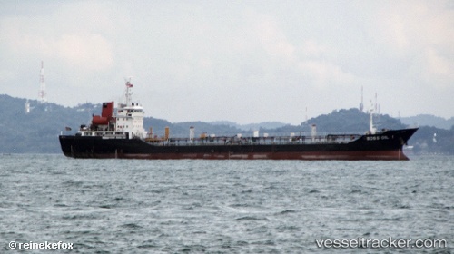
 AVA
AVA
Current Status
Where is the vessel?
AVA is currently in 17 nm S of Malacca, based on AIS data received about 1h ago.
Latest AIS update:
Current position: 1.89490° N, 102.31867° E (17 nm S of Malacca)
Average speed (last 7 days): Loading…
Average speed (last 30 days): Loading…
Vessel profile: AVA is a Oil Products Tanker with dimensions m x m.
This page combines live AIS, route history, probable destination signals, nearby traffic, and port activity for practical vessel monitoring.
The current position of vessel AVA is 1.89490 lat / 102.31867 lng. Updated: 2026-04-21 19:41:57 UTCNearest reference points:
- Near Malacca
- 12 nm S of Tangkak
- Near MELAKA
Currently sailing under the flag of Sierra Leone ![]()
Details:
Live Vessel AVA Analytics (details, animations, etc.)
Recent AIS points (UTC):
2026-04-21 16:26:18 UTC · 1.77049, 102.64026 · SOG 5.1 kn · COG -1°2026-04-21 18:09:08 UTC · 1.82680, 102.48646 · SOG 6.1 kn · COG -1°
2026-04-21 19:27:07 UTC · 1.88348, 102.34626 · SOG 7.2 kn · COG -1°
2026-04-21 19:41:57 UTC · 1.89490, 102.31867 · SOG 7.3 kn · COG -1°