 vesseltracker.com
 FERDINANDA S
Current Status
Where is the vessel?
FERDINANDA S is currently in 180 nm W of Port Etienne, based on AIS data received less than 1h ago.
Latest AIS update:
Current position: 20.55201° N, 20.26309° W (180 nm W of Port Etienne)
Average speed (last 7 days): Loading…
Average speed (last 30 days): Loading…
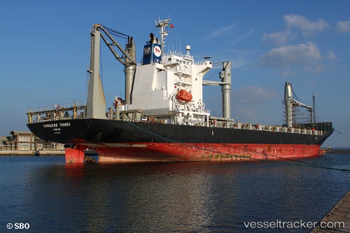
Vessel profile: FERDINANDA S is a Container Ship with dimensions 28m x 172m.
This page combines live AIS, route history, probable destination signals, nearby traffic, and port activity for practical vessel monitoring.
The current position of vessel FERDINANDA S is 20.55201 lat / -20.26309 lng. Updated: 2026-04-05 23:26:46 UTCNearest reference points:
- 176 nm NE of Ilha do Sal
- 108 nm SW of Port Etienne
- 119 nm W of Nouakchott
Currently sailing under the flag of Portugal (MAR) ![]()
FERDINANDA S built in 2008 year
Deadweight:
21464 tDetails:
Live Vessel FERDINANDA S Analytics (details, animations, etc.)
Recent AIS points (UTC):
2026-04-05 13:37:09 UTC · 22.45460, -19.27811 · SOG 12.8 kn · COG 203°2026-04-05 15:45:39 UTC · 22.04375, -19.48888 · SOG 12.8 kn · COG 205°
2026-04-05 21:24:15 UTC · 20.94279, -20.05418 · SOG 12.3 kn · COG 206°
2026-04-05 23:26:46 UTC · 20.55201, -20.26309 · SOG 13 kn · COG 207°