 vesseltracker.com
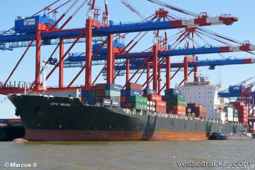
Navios Miami
Current StatusWhere is the vessel?
Navios Miami is currently in Near Seaview, based on AIS data received less than 1h ago.
Latest AIS update:
Current position: 39.47372° S, 176.91405° E (Near Seaview)
Average speed (last 7 days): Loading…
Average speed (last 30 days): Loading…
Vessel profile: Navios Miami is a Container Ship with dimensions 32m x 262m.
This page combines live AIS, route history, probable destination signals, nearby traffic, and port activity for practical vessel monitoring.
The current position of vessel Navios Miami is -39.47372 lat / 176.91405 lng. Updated: 2026-04-19 13:23:27 UTCDetails:
Live Vessel Navios Miami Analytics (details, animations, etc.)
Recent AIS points (UTC):
2026-04-19 10:50:24 UTC · -39.47369, 176.91403 · SOG 0 kn · COG 77°2026-04-19 12:11:26 UTC · -39.47370, 176.91402 · SOG 0 kn · COG 77°
2026-04-19 13:20:22 UTC · -39.47370, 176.91405 · SOG 0 kn · COG 77°
2026-04-19 13:23:27 UTC · -39.47372, 176.91405 · SOG 0 kn · COG 77°