 vesseltracker.com
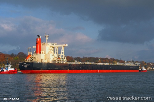
 CAPE HORN
Current Status
Where is the vessel?
CAPE HORN is currently in Near Whyalla, based on AIS data received about 2h ago.
Latest AIS update:
Current position: 33.09782° S, 137.63824° E (Near Whyalla)
Average speed (last 7 days): Loading…
Average speed (last 30 days): Loading…
Vessel profile: CAPE HORN is a Bulk Carrier with dimensions m x m.
This page combines live AIS, route history, probable destination signals, nearby traffic, and port activity for practical vessel monitoring.
The current position of vessel CAPE HORN is -33.09782 lat / 137.63824 lng. Updated: 2026-03-26 17:23:52 UTCNearest reference points:
- Near North Haven
- Near Gillman
- Near Port Adelaide
Currently sailing under the flag of Marshall Islands ![]()
Details:
Live Vessel CAPE HORN Analytics (details, animations, etc.)
Recent AIS points (UTC):
2026-03-26 11:27:50 UTC · -33.09667, 137.64000 · SOG 0 kn · COG -1°2026-03-26 14:21:45 UTC · -33.09833, 137.63667 · SOG 0 kn · COG -1°
2026-03-26 16:03:49 UTC · -33.09833, 137.63667 · SOG 0 kn · COG -1°
2026-03-26 17:23:52 UTC · -33.09782, 137.63824 · SOG 0 kn · COG 143°