 vesseltracker.com
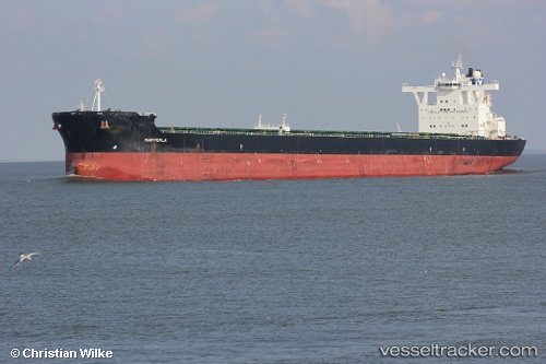
 Mariperla
Current Status
Where is the vessel?
Mariperla is currently in 75 nm SE of Taytay Sandoval, based on AIS data received about 1h ago.
Latest AIS update:
Current position: 10.01092° N, 120.48757° E (75 nm SE of Taytay Sandoval)
Average speed (last 7 days): Loading…
Average speed (last 30 days): Loading…
Vessel profile: Mariperla is a Bulk Carrier with dimensions 292m x 292m.
This page combines live AIS, route history, probable destination signals, nearby traffic, and port activity for practical vessel monitoring.
The current position of vessel Mariperla is 10.01092 lat / 120.48757 lng. Updated: 2026-03-29 22:03:26 UTCNearest reference points:
- 19 nm NE of CORON
- Near Iloilo
- Near BACOLOD
Currently sailing under the flag of Malta ![]()
Mariperla built in 2009 year
Deadweight:
179759 tDetails:
Live Vessel Mariperla Analytics (details, animations, etc.)
Recent AIS points (UTC):
2026-03-29 13:44:58 UTC · 8.34048, 120.23153 · SOG 11.5 kn · COG -1°2026-03-29 13:44:58 UTC · 8.34048, 120.23153 · SOG 11.5 kn · COG -1°
2026-03-29 19:36:33 UTC · 9.53051, 120.40303 · SOG 12 kn · COG -1°
2026-03-29 22:03:26 UTC · 10.01092, 120.48757 · SOG 11.6 kn · COG -1°