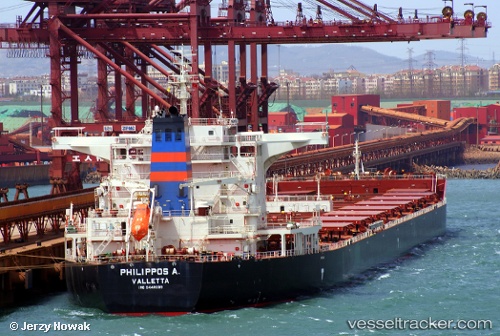
.
Vessel photo of Philippos A. (IMO 9448009) vesseltracker.com

MT flag Philippos A.

Vessel type: Bulk Carrier | IMO: 9448009 | MMSI: MMSI: 215038000
Call sign: 9HA2617 | Dimensions: 291 m x 45 m
Current Status

Where is the vessel?

Philippos A. is currently in 127 nm N of Port Mathurin, based on AIS data received about 4h ago.

Latest AIS update:

Current position: 17.61619° S, 62.95743° E (127 nm N of Port Mathurin)

Average speed (last 7 days): Loading…

Average speed (last 30 days): Loading…

Vessel profile: Philippos A. is a Bulk Carrier with dimensions 291m x 45m.

This page combines live AIS, route history, probable destination signals, nearby traffic, and port activity for practical vessel monitoring.

The current position of vessel Philippos A. is -17.61619 lat / 62.95743 lng. Updated: 2026-04-05 08:02:13 UTC
Nearest reference points:
  • 106 nm NW of Port Mathurin
  • 219 nm NW of Port Mathurin
  • 154 nm NE of Port Mathurin

Currently sailing under the flag of Malta MT flag

Details:

Live Vessel Philippos A. Analytics (details, animations, etc.)


Recent AIS points (UTC):
2026-04-05 02:36:49 UTC · -17.93263, 62.51574 · SOG 9.9 kn · COG 54°
2026-04-05 04:39:26 UTC · -17.89308, 62.54384 · SOG 0.6 kn · COG 116°
2026-04-05 06:04:05 UTC · -17.80628, 62.68463 · SOG 9.9 kn · COG 53°
2026-04-05 08:02:13 UTC · -17.61619, 62.95743 · SOG 9.7 kn · COG 53°

Track of the vessel in the last 60 days


UTC: --
Start: -- Track timeline (UTC) End: --
Encountered: --


Link to the map:


Find another ship

Philippos_A. (215038000) last ports (portcalls and passsages)

Xianlang | 2025-09-02 13:54:31
Qingdao | 2025-09-02 02:17:53
Selat Lombok | 2025-08-19 15:13:24
PORT WALCOTT | 2025-08-14 18:08:36
Samson Point | 2025-08-14 17:12:36
Selat Lombok | 2025-08-03 09:22:52
Zhangjiagang | 2025-07-21 03:35:13
Nantong | 2025-07-21 02:03:22
Taicang | 2025-07-20 14:34:50
Wusong | 2025-07-20 11:31:50
Jingjiang | 2025-07-20 06:46:10
PENGERANG | 2025-07-07 00:27:58
TANAH MERAH | 2025-07-05 10:15:04
PULAU SAMBU | 2025-07-05 08:34:30
BUKOM ISLAND | 2025-04-16 06:37:21
TANAH MERAH | 2025-04-15 03:25:53
PENGERANG | 2025-04-15 01:42:16
Taicang | 2025-04-03 09:16:36
Wusong | 2025-04-03 07:15:50
Jingjiang | 2025-04-03 01:52:50
Rizhao | 2025-03-29 10:32:24
Selat Lombok | 2025-03-16 10:16:10
Port Headland | 2025-03-12 04:35:37
Selat Lombok | 2025-03-03 10:30:44
JINGTANG | 2025-02-14 02:24:09
Port Headland | 2025-01-26 22:08:13
Selat Lombok | 2025-01-17 20:51:08
PENGERANG | 2025-01-13 16:07:25
TANAH MERAH | 2025-01-13 15:21:18
TANAH MERAH | 2025-01-09 08:46:00
PENGERANG | 2025-01-09 07:36:27
DANDONG | 2024-12-26 21:28:02
DALRYMPLE | 2024-12-05 04:46:17
Wusong | 2024-11-12 19:19:19
Uskudar | 2023-05-30 12:02:45
Gelibolu | 2023-05-28 23:24:21
Canakkale | 2023-05-28 21:49:07
Bur Ibrahim | 2023-05-21 04:30:16
Ra’S Shukhayr | 2023-05-20 08:00:48
Singapore | 2023-05-01 00:09:02
Yosu | 2023-04-12 08:10:53
Pohang | 2023-04-06 04:33:31
Canakkale | 2023-03-06 11:58:24
Ambarli | 2023-03-05 17:43:37
Uskudar | 2023-03-05 15:14:29
Uskudar | 2023-02-14 11:02:10
Kalamai | 2023-02-07 08:41:01
Kalamai | 2023-02-03 08:33:19
Kalamai | 2023-01-30 05:53:03
Botas | 2023-01-13 20:54:58
Botas | 2023-01-09 17:25:59
Algeciras | 2022-11-28 14:41:24
Port Said | 2022-10-19 19:44:26
Bur Ibrahim | 2022-10-19 10:08:54
Vishakhapatnam | 2022-10-02 16:14:33
Vishakhapatnam | 2022-09-28 16:09:24
Ra’S Shukhayr | 2022-09-05 01:11:53
Port Said | 2022-09-04 04:55:54
Korsor | 2022-08-07 19:32:03
Skagens Odde | 2022-08-06 19:29:16
Strait Of Gibraltar | 2022-07-31 22:42:05
Port Said | 2022-07-25 16:28:29
Ra’S Shukhayr | 2022-07-24 04:20:02
Wusong | 2022-06-25 01:09:18
Selat Lombok | 2022-06-07 10:20:05
Port Headland | 2022-06-03 07:07:28
Dampier | 2022-02-22 03:10:52
Selat Lombok | 2022-02-10 15:26:58
Wusong | 2022-01-23 09:08:33
Sambu | 2021-12-28 23:05:04
Singapore | 2021-12-28 22:20:13
Sambu | 2021-12-28 22:15:12