 vesseltracker.com
 LA DIGUE
Current Status
Where is the vessel?
LA DIGUE is currently in 48 nm SE of Konwelana, based on AIS data received about 2h ago.
Latest AIS update:
Current position: 5.74568° N, 81.91663° E (48 nm SE of Konwelana)
Average speed (last 7 days): Loading…
Average speed (last 30 days): Loading…
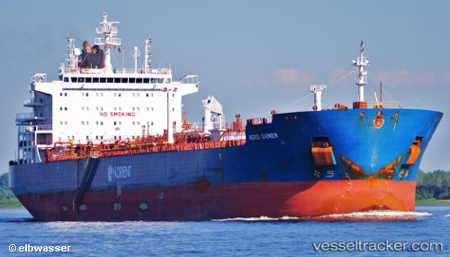
Vessel profile: LA DIGUE is a Chemical/Oil Products Tanker with dimensions 32m x 183m.
This page combines live AIS, route history, probable destination signals, nearby traffic, and port activity for practical vessel monitoring.
The current position of vessel LA DIGUE is 5.74568 lat / 81.91663 lng. Updated: 2026-03-29 09:28:08 UTCNearest reference points:
- 53 nm SE of Konwelana
- 75 nm E of Konwelana
- 40 nm E of Konwelana
Currently sailing under the flag of Marshall Islands ![]()
LA DIGUE built in 2011 year
Deadweight:
50281 tDetails:
Live Vessel LA DIGUE Analytics (details, animations, etc.)
Recent AIS points (UTC):
2026-03-29 03:23:17 UTC · 5.71967, 80.75083 · SOG 11.9 kn · COG 88°2026-03-29 05:42:18 UTC · 5.72161, 81.20172 · SOG 11.4 kn · COG 85°
2026-03-29 08:05:15 UTC · 5.73333, 81.65667 · SOG 11 kn · COG -1°
2026-03-29 09:28:08 UTC · 5.74568, 81.91663 · SOG 11.2 kn · COG 86°