 vesseltracker.com
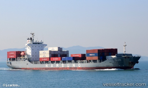
Star Skipper
Current StatusWhere is the vessel?
Star Skipper is currently in 22 nm NW of Unnan, based on AIS data received less than 1h ago.
Latest AIS update:
Current position: 35.62108° N, 132.71027° E (22 nm NW of Unnan)
Average speed (last 7 days): Loading…
Average speed (last 30 days): Loading…
Vessel profile: Star Skipper is a Container Ship with dimensions 22m x 142m.
This page combines live AIS, route history, probable destination signals, nearby traffic, and port activity for practical vessel monitoring.
The current position of vessel Star Skipper is 35.62108 lat / 132.71027 lng. Updated: 2026-03-30 16:00:37 UTCNearest reference points:
- 37 nm NW of NAKANOSHIMA
- 63 nm NW of Unnan
- 39 nm N of Iwami
Details:
Live Vessel Star Skipper Analytics (details, animations, etc.)
Recent AIS points (UTC):
2026-03-30 09:48:50 UTC · 35.35649, 131.01608 · SOG 13.8 kn · COG -1°2026-03-30 11:14:41 UTC · 35.42327, 131.40868 · SOG 13.6 kn · COG -1°
2026-03-30 13:34:43 UTC · 35.51754, 132.04602 · SOG 13.8 kn · COG -1°
2026-03-30 16:00:37 UTC · 35.62108, 132.71027 · SOG 13.6 kn · COG 80°