 vesseltracker.com
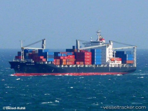
 Callao Bridge
Current Status
Where is the vessel?
Callao Bridge is currently in 43 nm SE of Zhuangyuanao, based on AIS data received about 2h ago.
Latest AIS update:
Current position: 27.23167° N, 121.43333° E (43 nm SE of Zhuangyuanao)
Average speed (last 7 days): Loading…
Average speed (last 30 days): Loading…
Vessel profile: Callao Bridge is a Container Ship with dimensions 199m x 32m.
This page combines live AIS, route history, probable destination signals, nearby traffic, and port activity for practical vessel monitoring.
The current position of vessel Callao Bridge is 27.23167 lat / 121.43333 lng. Updated: 2026-04-18 05:28:06 UTCNearest reference points:
- 33 nm S of Zhuangyuanao
- 36 nm SE of Zhuangyuanao
- 27 nm SE of Zhuangyuanao
Currently sailing under the flag of Panama ![]()
Callao Bridge built in 2010 year
Deadweight:
33008 tDetails:
Live Vessel Callao Bridge Analytics (details, animations, etc.)
Recent AIS points (UTC):
2026-04-17 23:46:05 UTC · 28.17833, 122.06500 · SOG 11 kn · COG -1°2026-04-18 01:31:06 UTC · 27.88500, 121.85667 · SOG 12 kn · COG -1°
2026-04-18 03:34:05 UTC · 27.53833, 121.62333 · SOG 11 kn · COG -1°
2026-04-18 05:28:06 UTC · 27.23167, 121.43333 · SOG 10 kn · COG -1°