 vesseltracker.com
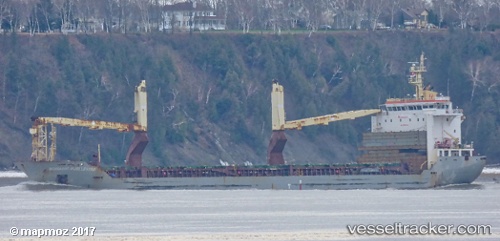
 Nomadic Hjellestad
Current Status
Where is the vessel?
Nomadic Hjellestad is currently in Near Puerto San José, based on AIS data received less than 1h ago.
Latest AIS update:
Current position: 13.85936° N, 90.80264° W (Near Puerto San José)
Average speed (last 7 days): Loading…
Average speed (last 30 days): Loading…
Vessel profile: Nomadic Hjellestad is a Multi Purpose Carrier with dimensions 138m x 21m.
This page combines live AIS, route history, probable destination signals, nearby traffic, and port activity for practical vessel monitoring.
The current position of vessel Nomadic Hjellestad is 13.85936 lat / -90.80264 lng. Updated: 2026-03-30 00:03:31 UTCNearest reference points:
- Near San Jose
Currently sailing under the flag of Marshall Is ![]()
Nomadic Hjellestad built in 2010 year
Deadweight:
12940 tDetails:
Live Vessel Nomadic Hjellestad Analytics (details, animations, etc.)
Recent AIS points (UTC):
2026-03-29 17:57:31 UTC · 13.85957, -90.80471 · SOG 0.1 kn · COG 157°2026-03-29 20:00:30 UTC · 13.85991, -90.80384 · SOG 0.1 kn · COG 180°
2026-03-29 21:30:31 UTC · 13.85944, -90.80264 · SOG 0.1 kn · COG 230°
2026-03-30 00:03:31 UTC · 13.85936, -90.80264 · SOG 0.2 kn · COG 233°