 vesseltracker.com
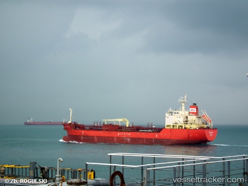
 SUPER FORTE
Current Status
Where is the vessel?
SUPER FORTE is currently in 230 nm W of Bolinao, based on AIS data received about 3h ago.
Latest AIS update:
Current position: 16.52116° N, 115.89722° E (230 nm W of Bolinao)
Average speed (last 7 days): Loading…
Average speed (last 30 days): Loading…
Vessel profile: SUPER FORTE is a Oil/Chemical Tanker with dimensions m x m.
This page combines live AIS, route history, probable destination signals, nearby traffic, and port activity for practical vessel monitoring.
The current position of vessel SUPER FORTE is 16.52116 lat / 115.89722 lng. Updated: 2026-03-29 08:02:35 UTCNearest reference points:
- 222 nm W of Iba
- 138 nm NW of Bolinao
- 282 nm E of Tan Cang Qui Nhon
Currently sailing under the flag of South Korea ![]()
Details:
Live Vessel SUPER FORTE Analytics (details, animations, etc.)
Recent AIS points (UTC):
2026-03-29 03:37:44 UTC · 15.81987, 115.36386 · SOG 11.9 kn · COG 37°2026-03-29 05:42:26 UTC · 16.15604, 115.59982 · SOG 11.4 kn · COG 44°
2026-03-29 07:29:15 UTC · 16.43274, 115.83044 · SOG 12 kn · COG 36°
2026-03-29 08:02:35 UTC · 16.52116, 115.89722 · SOG 11.6 kn · COG 36°