 vesseltracker.com
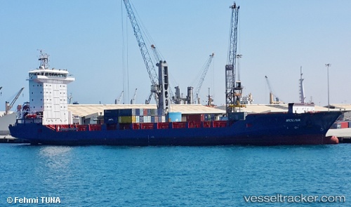
 MOLIVA
Current Status
Where is the vessel?
MOLIVA is currently in Near Mersin, based on AIS data received less than 1h ago.
Latest AIS update:
Current position: 36.63742° N, 34.58150° E (Near Mersin)
Average speed (last 7 days): Loading…
Average speed (last 30 days): Loading…
Vessel profile: MOLIVA is a Cargo A with dimensions m x m.
This page combines live AIS, route history, probable destination signals, nearby traffic, and port activity for practical vessel monitoring.
The current position of vessel MOLIVA is 36.63742 lat / 34.58150 lng. Updated: 2026-04-21 12:18:39 UTCNearest reference points:
- Near Mersin
- Near Mersin-Free Zone
- 15 nm SW of Yesilovacik
Currently sailing under the flag of Turkey ![]()
Details:
Live Vessel MOLIVA Analytics (details, animations, etc.)
Recent AIS points (UTC):
2026-04-21 07:35:34 UTC · 36.80319, 34.64368 · SOG 0 kn · COG 33°2026-04-21 08:07:19 UTC · 36.80317, 34.64365 · SOG 0 kn · COG 33°
2026-04-21 09:22:17 UTC · 36.80318, 34.64370 · SOG 0 kn · COG 33°
2026-04-21 12:18:39 UTC · 36.63742, 34.58150 · SOG 13.8 kn · COG 224°