 vesseltracker.com
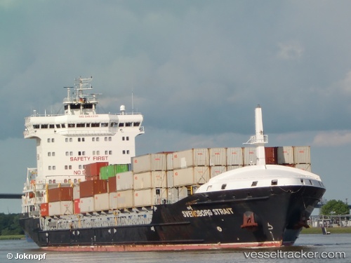
 Svendborg
Current Status
Where is the vessel?
Svendborg is currently in Near Eggstedt, based on AIS data received about 1h ago.
Latest AIS update:
Current position: 54.04928° N, 9.30612° E (Near Eggstedt)
Average speed (last 7 days): Loading…
Average speed (last 30 days): Loading…
Vessel profile: Svendborg is a Container Ship with dimensions 158m x 24m.
This page combines live AIS, route history, probable destination signals, nearby traffic, and port activity for practical vessel monitoring.
The current position of vessel Svendborg is 54.04928 lat / 9.30612 lng. Updated: 2026-04-18 12:20:48 UTCNearest reference points:
- Near Kiel Canal
- Near Abbenfleth
- Near Stader Sand
Currently sailing under the flag of Portugal ![]()
Svendborg built in 2011 year
Deadweight:
14220 tDetails:
Live Vessel Svendborg Analytics (details, animations, etc.)
Recent AIS points (UTC):
2026-04-18 06:17:05 UTC · 53.99390, 8.23874 · SOG 13.3 kn · COG 93°2026-04-18 07:58:01 UTC · 53.84925, 8.76116 · SOG 12.9 kn · COG 125°
2026-04-18 09:49:28 UTC · 53.89291, 9.14359 · SOG 0 kn · COG 48°
2026-04-18 12:20:48 UTC · 54.04928, 9.30612 · SOG 6.3 kn · COG 9°