 vesseltracker.com
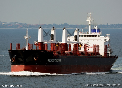
 CLIPPER DEE
Current Status
Where is the vessel?
CLIPPER DEE is currently in 16 nm W of CHANGXINDAO, based on AIS data received about 2h ago.
Latest AIS update:
Current position: 39.57452° N, 120.99801° E (16 nm W of CHANGXINDAO)
Average speed (last 7 days): Loading…
Average speed (last 30 days): Loading…
Vessel profile: CLIPPER DEE is a Bulk Carrier with dimensions 176m x 27m.
This page combines live AIS, route history, probable destination signals, nearby traffic, and port activity for practical vessel monitoring.
The current position of vessel CLIPPER DEE is 39.57452 lat / 120.99801 lng. Updated: 2026-04-17 15:31:04 UTCNearest reference points:
- 30 nm NW of CHANGXINDAO
- 37 nm W of CHANGXINDAO
- 37 nm SE of SHANHAIGUAN
Currently sailing under the flag of Marshall Islands ![]()
CLIPPER DEE built in 2013 year
Deadweight:
31716 tDetails:
Live Vessel CLIPPER DEE Analytics (details, animations, etc.)
Recent AIS points (UTC):
2026-04-17 10:20:24 UTC · 40.28089, 121.82890 · SOG 10.9 kn · COG 230°2026-04-17 11:58:34 UTC · 40.08287, 121.51314 · SOG 11.7 kn · COG 231°
2026-04-17 13:22:54 UTC · 39.88513, 121.27578 · SOG 11.2 kn · COG 217°
2026-04-17 15:31:04 UTC · 39.57452, 120.99801 · SOG 9.8 kn · COG 214°