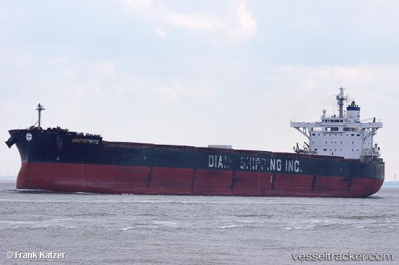
.
Vessel photo of Amphitrite (IMO 9455973) vesseltracker.com

Amphitrite

Vessel type: Crude Oil Tanker | IMO: 9455973 | MMSI: MMSI: 256906000
Call sign: 9HA4033 | Dimensions: 60 m x 333 m
Current Status

Where is the vessel?

Amphitrite is currently in 59 nm NE of MALAHAYATI, based on AIS data received less than 1h ago.

Latest AIS update:

Current position: 6.26127° N, 96.24954° E (59 nm NE of MALAHAYATI)

Average speed (last 7 days): Loading…

Average speed (last 30 days): Loading…

Vessel profile: Amphitrite is a Crude Oil Tanker with dimensions 60m x 333m.

This page combines live AIS, route history, probable destination signals, nearby traffic, and port activity for practical vessel monitoring.

The current position of vessel Amphitrite is 6.26127 lat / 96.24954 lng. Updated: 2026-04-03 21:25:49 UTC
Nearest reference points:
  • 53 nm NE of Sebang
  • 21 nm N of Sebang
  • 28 nm NW of Sebang
Details:

Live Vessel Amphitrite Analytics (details, animations, etc.)


Recent AIS points (UTC):
2026-04-03 15:52:26 UTC · 6.35496, 95.10122 · SOG 12.5 kn · COG 113°
2026-04-03 17:32:26 UTC · 6.35910, 95.44636 · SOG 12.9 kn · COG 91°
2026-04-03 20:31:56 UTC · 6.28477, 96.05627 · SOG 12.6 kn · COG 94°
2026-04-03 21:25:49 UTC · 6.26127, 96.24954 · SOG 13.3 kn · COG 99°

Track of the vessel in the last 60 days


UTC: --
Start: -- Track timeline (UTC) End: --
Encountered: --


Link to the map:


Find another ship

Amphitrite (256906000) last ports (portcalls and passsages)

Luoyuanwan | 2025-09-14 11:41:41
Luoyuanwan | 2025-09-08 11:05:30
LUOYUAN | 2025-09-03 08:47:39
Luoyuanwan | 2025-09-02 13:42:10
LUOYUAN | 2025-08-30 04:39:14
LUOYUAN | 2025-08-26 04:03:33
LUOYUAN | 2025-08-22 03:06:46
LUOYUAN | 2025-08-18 02:26:18
LANSHAN | 2025-08-06 08:15:32
Qingdao | 2025-08-03 01:57:34
PENGERANG | 2025-07-21 18:21:12
TANAH MERAH | 2025-07-20 23:16:07
PULAU SAMBU | 2025-05-01 16:36:10
Sambu | 2025-05-01 16:03:25
BATU AMPAR | 2025-04-30 15:23:33
TANAH MERAH | 2025-04-30 13:58:32
PENGERANG | 2025-04-30 12:51:52
RAYONG | 2025-04-25 21:25:42
PENGERANG | 2025-04-23 08:40:01
TANAH MERAH | 2025-04-23 07:41:13
PULAU SAMBU | 2025-04-23 06:54:35
SUNGAI UDANG | 2025-04-20 18:16:56
Halul Island | 2025-04-04 19:22:25
Mesaieed | 2025-04-03 04:23:08
BUKOM ISLAND | 2025-03-21 20:26:45
TANAH MERAH | 2025-03-19 18:04:48
MAILIAO | 2025-03-12 00:51:22
PENGERANG | 2025-02-26 22:06:11
TANAH MERAH | 2025-02-26 19:34:55
PULAU SAMBU | 2025-02-26 18:13:58
SULTAN QABOOS | 2025-02-11 20:28:12
MINA AL FAHL | 2025-02-11 19:32:20
BUKOM ISLAND | 2025-01-27 04:45:40
PULAU SAMBU | 2025-01-25 12:54:06
BUKOM ISLAND | 2025-01-21 11:12:24
JURONG ISLAND | 2025-01-21 01:46:02
Singapore | 2024-10-29 01:50:05
Sambu | 2024-10-29 01:25:22
Sriracha | 2024-10-21 18:07:21
Singapore | 2024-06-12 00:15:34
Sambu | 2024-06-11 10:46:12
Kaohsiung | 2024-05-28 01:29:07
Sambu | 2024-05-22 02:40:59
Ras Tannurah | 2024-05-06 15:32:17
Sambu | 2024-04-21 00:28:41
Singapore | 2024-04-21 00:12:31
Sambu | 2023-12-30 22:58:44
Singapore | 2023-12-29 20:22:31
Singapore | 2023-11-25 02:39:17
Sambu | 2023-08-27 14:45:48
Mutrah | 2023-08-12 15:35:55
Port Louis | 2023-02-23 12:07:37
Pointe Noire | 2023-02-06 06:03:08
Singapore | 2023-01-07 20:19:23
Fujairah | 2022-12-01 17:23:49
Az Zarqa Island | 2022-11-28 11:39:12
Singapore | 2022-05-27 04:13:33
Singapore | 2022-01-30 07:43:09
Ulsan | 2022-01-03 06:37:29
Mina Az Zawr | 2021-12-01 03:20:10