 vesseltracker.com
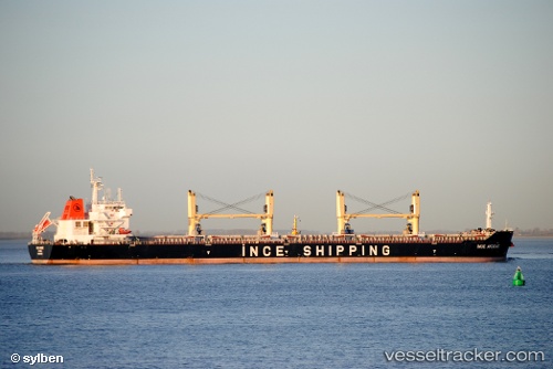
 AN HAI PEARL
Current Status
Where is the vessel?
AN HAI PEARL is currently in 341 nm SE of Abakaliki, based on AIS data received about 1h ago.
Latest AIS update:
Current position: 1.77724° N, 89.41294° E (341 nm SE of Abakaliki)
Average speed (last 7 days): Loading…
Average speed (last 30 days): Loading…
Vessel profile: AN HAI PEARL is a Bulk Carrier with dimensions m x m.
This page combines live AIS, route history, probable destination signals, nearby traffic, and port activity for practical vessel monitoring.
The current position of vessel AN HAI PEARL is 1.77724 lat / 89.41294 lng. Updated: 2026-03-29 20:06:44 UTCNearest reference points:
- Open sea, approx. 402 nm off the nearest listed port
- Open sea, approx. 406 nm off the nearest listed port
- Open sea, approx. 405 nm off the nearest listed port
Currently sailing under the flag of Panama ![]()
Details:
Live Vessel AN HAI PEARL Analytics (details, animations, etc.)
Recent AIS points (UTC):
2026-03-29 14:12:59 UTC · 2.39208, 90.20549 · SOG 9.8 kn · COG 234°2026-03-29 15:35:59 UTC · 2.25318, 90.02701 · SOG 9.9 kn · COG 231°
2026-03-29 17:59:46 UTC · 2.00204, 89.70564 · SOG 10.2 kn · COG 231°
2026-03-29 20:06:44 UTC · 1.77724, 89.41294 · SOG 10.3 kn · COG -1°