 vesseltracker.com
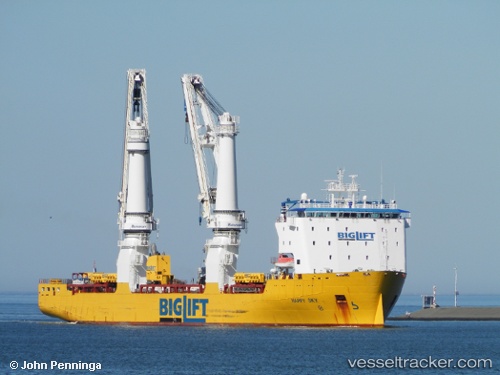
 Happy Sky
Current Status
Where is the vessel?
Happy Sky is currently in Near Ward Cove, based on AIS data received less than 1h ago.
Latest AIS update:
Current position: 55.39099° N, 131.74646° W (Near Ward Cove)
Average speed (last 7 days): Loading…
Average speed (last 30 days): Loading…
Vessel profile: Happy Sky is a Heavy Load Carrier with dimensions 154m x 27m.
This page combines live AIS, route history, probable destination signals, nearby traffic, and port activity for practical vessel monitoring.
The current position of vessel Happy Sky is 55.39099 lat / -131.74646 lng. Updated: 2026-04-20 05:54:41 UTCNearest reference points:
- Near Ward Cove
- Near Wrangell
- 15 nm N of Port Clements
Currently sailing under the flag of Netherlands ![]()
Happy Sky built in 2013 year
Deadweight:
18680 tDetails:
Live Vessel Happy Sky Analytics (details, animations, etc.)
Recent AIS points (UTC):
2026-04-20 01:27:45 UTC · 55.39102, -131.74677 · SOG 0.2 kn · COG 306°2026-04-20 03:33:41 UTC · 55.39097, -131.74612 · SOG 0 kn · COG 279°
2026-04-20 04:30:42 UTC · 55.39108, -131.74640 · SOG 0 kn · COG 249°
2026-04-20 05:54:41 UTC · 55.39099, -131.74646 · SOG 0 kn · COG 264°