 vesseltracker.com
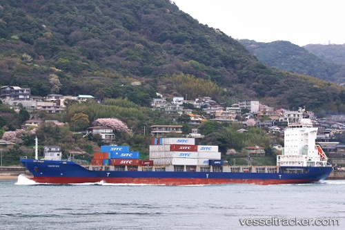
 Harrier
Current Status
Where is the vessel?
Harrier is currently in Near Tsing Yi, based on AIS data received about 22h ago.
Latest AIS update:
Current position: 22.32940° N, 114.08963° E (Near Tsing Yi)
Average speed (last 7 days): Loading…
Average speed (last 30 days): Loading…
Vessel profile: Harrier is a Container Ship with dimensions 148m x 23m.
This page combines live AIS, route history, probable destination signals, nearby traffic, and port activity for practical vessel monitoring.
The current position of vessel Harrier is 22.32940 lat / 114.08963 lng. Updated: 2026-04-10 08:10:21 UTCNearest reference points:
- Near Ting Kau
- Near Lai Chi Kok
- Near Kennedy Town
Currently sailing under the flag of Bahamas ![]()
Details:
Live Vessel Harrier Analytics (details, animations, etc.)
Recent AIS points (UTC):
2026-04-10 01:38:05 UTC · 21.98548, 114.28123 · SOG 14.3 kn · COG 79°2026-04-10 04:12:34 UTC · 22.22327, 114.15963 · SOG 12.6 kn · COG 306°
2026-04-10 05:54:45 UTC · 22.32943, 114.08962 · SOG 0.2 kn · COG 327°
2026-04-10 08:10:21 UTC · 22.32940, 114.08963 · SOG 0.2 kn · COG 327°