 vesseltracker.com
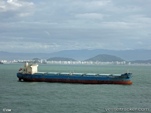
 Wadi Alyarmouk
Current Status
Where is the vessel?
Wadi Alyarmouk is currently in 47 nm SW of Cpc Terminal, based on AIS data received about 2h ago.
Latest AIS update:
Current position: 44.18691° N, 36.77541° E (47 nm SW of Cpc Terminal)
Average speed (last 7 days): Loading…
Average speed (last 30 days): Loading…
Vessel profile: Wadi Alyarmouk is a Bulk Carrier with dimensions 229m x 32m.
This page combines live AIS, route history, probable destination signals, nearby traffic, and port activity for practical vessel monitoring.
The current position of vessel Wadi Alyarmouk is 44.18691 lat / 36.77541 lng. Updated: 2026-04-22 15:57:30 UTCNearest reference points:
- 26 nm SW of Cpc Terminal
- 21 nm S of Taman'
- 20 nm S of Taman'
Currently sailing under the flag of Egypt ![]()
Details:
Live Vessel Wadi Alyarmouk Analytics (details, animations, etc.)
Recent AIS points (UTC):
2026-04-22 13:27:16 UTC · 44.39624, 37.40047 · SOG 11.5 kn · COG -1°2026-04-22 15:57:30 UTC · 44.18691, 36.77541 · SOG 15.6 kn · COG -1°
2026-04-22 15:57:30 UTC · 44.18691, 36.77541 · SOG 15.6 kn · COG -1°
2026-04-22 15:57:30 UTC · 44.18691, 36.77541 · SOG 15.6 kn · COG -1°