 vesseltracker.com
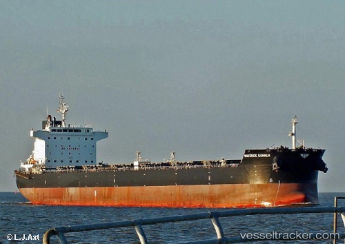
 Panagiotis
Current Status
Where is the vessel?
Panagiotis is currently in Near Chengxi, based on AIS data received less than 1h ago.
Latest AIS update:
Current position: 31.92485° N, 120.22236° E (Near Chengxi)
Average speed (last 7 days): Loading…
Average speed (last 30 days): Loading…
Vessel profile: Panagiotis is a Bulk Carrier with dimensions 229m x 32m.
This page combines live AIS, route history, probable destination signals, nearby traffic, and port activity for practical vessel monitoring.
The current position of vessel Panagiotis is 31.92485 lat / 120.22236 lng. Updated: 2026-04-16 21:27:45 UTCNearest reference points:
- Near Chengxi
- Near Jiangyin Pt
- Near Jingjiang Pt
Currently sailing under the flag of Marshall Is ![]()
Panagiotis built in 2010 year
Deadweight:
80717 tDetails:
Live Vessel Panagiotis Analytics (details, animations, etc.)
Recent AIS points (UTC):
2026-04-16 14:09:42 UTC · 31.92487, 120.22241 · SOG 0 kn · COG 349°2026-04-16 16:09:42 UTC · 31.92488, 120.22238 · SOG 0.1 kn · COG 349°
2026-04-16 19:21:43 UTC · 31.92486, 120.22237 · SOG 0.1 kn · COG 349°
2026-04-16 21:27:45 UTC · 31.92485, 120.22236 · SOG 0.1 kn · COG 349°