 vesseltracker.com
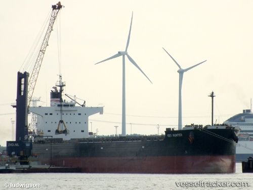
 KEY HUNTER
Current Status
Where is the vessel?
KEY HUNTER is currently in Near Sakaide, based on AIS data received about 1h ago.
Latest AIS update:
Current position: 34.35333° N, 133.84332° E (Near Sakaide)
Average speed (last 7 days): Loading…
Average speed (last 30 days): Loading…
Vessel profile: KEY HUNTER is a Bulk Carrier with dimensions m x m.
This page combines live AIS, route history, probable destination signals, nearby traffic, and port activity for practical vessel monitoring.
The current position of vessel KEY HUNTER is 34.35333 lat / 133.84332 lng. Updated: 2026-04-16 09:35:15 UTCNearest reference points:
- Near Sakaide
- Near Ayagawa
- Near MIZUSHIMA
Currently sailing under the flag of Japan ![]()
Details:
Live Vessel KEY HUNTER Analytics (details, animations, etc.)
Recent AIS points (UTC):
2026-04-16 03:31:46 UTC · 34.35378, 133.84483 · SOG 0 kn · COG 224°2026-04-16 06:16:33 UTC · 34.35383, 133.84489 · SOG 0 kn · COG 224°
2026-04-16 07:37:47 UTC · 34.35384, 133.84483 · SOG 0 kn · COG 224°
2026-04-16 09:35:15 UTC · 34.35333, 133.84332 · SOG 0 kn · COG -1°