 vesseltracker.com
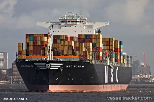
Msc Rosa M
Current StatusWhere is the vessel?
Msc Rosa M is currently in 88 nm SW of Boboras, based on AIS data received less than 1h ago.
Latest AIS update:
Current position: 45.09333° N, 9.01167° W (88 nm SW of Boboras)
Average speed (last 7 days): Loading…
Average speed (last 30 days): Loading…
Vessel profile: Msc Rosa M is a Container Ship with dimensions 51m x 366m.
This page combines live AIS, route history, probable destination signals, nearby traffic, and port activity for practical vessel monitoring.
The current position of vessel Msc Rosa M is 45.09333 lat / -9.01167 lng. Updated: 2026-04-09 19:21:03 UTCNearest reference points:
- 57 nm S of Boboras
- 30 nm NW of Meiras-Valdoviño
- 15 nm NW of CEDEIRA
Details:
Live Vessel Msc Rosa M Analytics (details, animations, etc.)
Recent AIS points (UTC):
2026-04-09 18:06:02 UTC · 44.76500, -9.27167 · SOG 18 kn · COG -1°2026-04-09 18:06:02 UTC · 44.76500, -9.27167 · SOG 18 kn · COG -1°
2026-04-09 19:21:03 UTC · 45.09333, -9.01167 · SOG 18 kn · COG -1°
2026-04-09 19:21:03 UTC · 45.09333, -9.01167 · SOG 18 kn · COG -1°