 vesseltracker.com
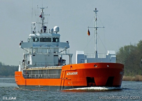
 WILMA
WILMA
Current Status
Where is the vessel?
WILMA is currently in 18 nm N of Ile D’Ouessant, based on AIS data received less than 1h ago.
Latest AIS update:
Current position: 48.97003° N, 5.50680° W (18 nm N of Ile D’Ouessant)
Average speed (last 7 days): Loading…
Average speed (last 30 days): Loading…
Vessel profile: WILMA is a General Cargo Ship with dimensions 89m x 13m.
This page combines live AIS, route history, probable destination signals, nearby traffic, and port activity for practical vessel monitoring.
The current position of vessel WILMA is 48.97003 lat / -5.50680 lng. Updated: 2026-04-22 07:23:49 UTCNearest reference points:
- 18 nm NE of Ile D’Ouessant
- 16 nm NW of Ile D’Ouessant
- 34 nm W of Verzy
Currently sailing under the flag of Cyprus ![]()
WILMA built in 2009 year
Deadweight:
3794 tDetails:
Live Vessel WILMA Analytics (details, animations, etc.)
Recent AIS points (UTC):
2026-04-22 04:02:20 UTC · 49.18054, -4.96815 · SOG 8.2 kn · COG 238°2026-04-22 05:00:19 UTC · 49.11626, -5.13654 · SOG 7.3 kn · COG 235°
2026-04-22 06:21:50 UTC · 49.03255, -5.35186 · SOG 6.8 kn · COG 234°
2026-04-22 07:23:49 UTC · 48.97003, -5.50680 · SOG 6.8 kn · COG 230°