 vesseltracker.com
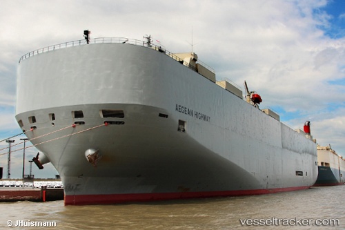
 Aegean Highway
Current Status
Where is the vessel?
Aegean Highway is currently in Near Hettimulla, based on AIS data received about 1h ago.
Latest AIS update:
Current position: 7.12840° N, 80.07802° W (Near Hettimulla)
Average speed (last 7 days): Loading…
Average speed (last 30 days): Loading…
Vessel profile: Aegean Highway is a Vehicles Carrier with dimensions 199m x 32m.
This page combines live AIS, route history, probable destination signals, nearby traffic, and port activity for practical vessel monitoring.
The current position of vessel Aegean Highway is 7.12840 lat / -80.07802 lng. Updated: 2026-04-21 06:09:06 UTCNearest reference points:
- 30 nm E of El Cirial (Isla Iguana)
- 20 nm S of El Puerto
- Near Saboga
Currently sailing under the flag of Japan ![]()
Aegean Highway built in 2008 year
Deadweight:
18867 tDetails:
Live Vessel Aegean Highway Analytics (details, animations, etc.)
Recent AIS points (UTC):
2026-04-21 02:41:17 UTC · 7.87315, -79.46080 · SOG 17.8 kn · COG 184°2026-04-21 03:46:16 UTC · 7.60470, -79.56473 · SOG 17.4 kn · COG 226°
2026-04-21 04:09:51 UTC · 7.52950, -79.65056 · SOG 17.2 kn · COG 237°
2026-04-21 06:09:06 UTC · 7.12840, -80.07802 · SOG 18.1 kn · COG 227°