 vesseltracker.com
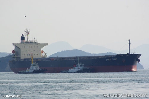
 Coral Ruby
Current Status
Where is the vessel?
Coral Ruby is currently in 14 nm SE of Bunati, based on AIS data received about 1h ago.
Latest AIS update:
Current position: 3.93423° S, 115.76472° E (14 nm SE of Bunati)
Average speed (last 7 days): Loading…
Average speed (last 30 days): Loading…
Vessel profile: Coral Ruby is a Bulk Carrier with dimensions 225m x 32m.
This page combines live AIS, route history, probable destination signals, nearby traffic, and port activity for practical vessel monitoring.
The current position of vessel Coral Ruby is -3.93423 lat / 115.76472 lng. Updated: 2026-04-17 13:37:11 UTCNearest reference points:
- 12 nm SE of Bunati
- Near Bunati
- Near TANJUNG PEMANCINGAN
Currently sailing under the flag of Panama ![]()
Coral Ruby built in 2008 year
Deadweight:
76596 tDetails:
Live Vessel Coral Ruby Analytics (details, animations, etc.)
Recent AIS points (UTC):
2026-04-17 07:07:08 UTC · -3.93242, 115.76753 · SOG 0 kn · COG 183°2026-04-17 09:22:11 UTC · -3.93198, 115.76568 · SOG 0.1 kn · COG 149°
2026-04-17 11:58:09 UTC · -3.93453, 115.76470 · SOG 0 kn · COG 77°
2026-04-17 13:37:11 UTC · -3.93423, 115.76472 · SOG 0.1 kn · COG 88°