 vesseltracker.com
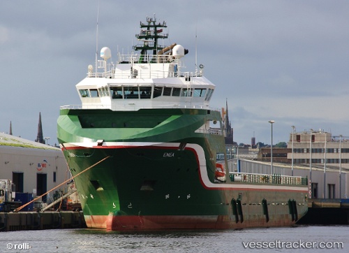
 Enea
Enea
Current Status
Where is the vessel?
Enea is currently in 18 nm W of Etrick Field, based on AIS data received about 1h ago.
Latest AIS update:
Current position: 57.87833° N, 1.13167° W (18 nm W of Etrick Field)
Average speed (last 7 days): Loading…
Average speed (last 30 days): Loading…
Vessel profile: Enea is a Offshore Tug Supply Ship with dimensions 87m x 20m.
This page combines live AIS, route history, probable destination signals, nearby traffic, and port activity for practical vessel monitoring.
The current position of vessel Enea is 57.87833 lat / -1.13167 lng. Updated: 2026-04-01 23:57:20 UTCNearest reference points:
- Near Peterhead
- Near PETERHEAD
- Near Aberdeen
Currently sailing under the flag of United Kingdom ![]()
Enea built in 2010 year
Deadweight:
4993 tDetails:
Live Vessel Enea Analytics (details, animations, etc.)
Recent AIS points (UTC):
2026-04-01 18:15:19 UTC · 58.86333, 0.04667 · SOG 11 kn · COG -1°2026-04-01 19:33:19 UTC · 58.64167, -0.20667 · SOG 12 kn · COG -1°
2026-04-01 21:34:17 UTC · 58.29666, -0.61851 · SOG 12.2 kn · COG 213°
2026-04-01 23:57:20 UTC · 57.87833, -1.13167 · SOG 12 kn · COG -1°