 vesseltracker.com
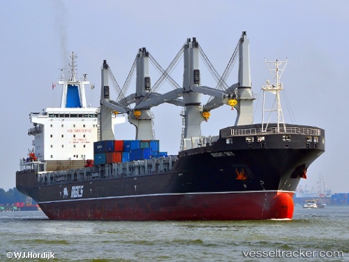
 Bright Sky
Current Status
Where is the vessel?
Bright Sky is currently in 356 nm S of Malaga, based on AIS data received about 1h ago.
Latest AIS update:
Current position: 1.96622° S, 6.15040° W (356 nm S of Malaga)
Average speed (last 7 days): Loading…
Average speed (last 30 days): Loading…
Vessel profile: Bright Sky is a Multi Purpose Carrier with dimensions 200m x 30m.
This page combines live AIS, route history, probable destination signals, nearby traffic, and port activity for practical vessel monitoring.
The current position of vessel Bright Sky is -1.96622 lat / -6.15040 lng. Updated: 2026-04-17 15:51:57 UTCNearest reference points:
- Open sea, approx. 403 nm off the nearest listed port
- Open sea, approx. 406 nm off the nearest listed port
- Open sea, approx. 407 nm off the nearest listed port
Currently sailing under the flag of Marshall Is ![]()
Bright Sky built in 2013 year
Deadweight:
37472 tDetails:
Live Vessel Bright Sky Analytics (details, animations, etc.)
Recent AIS points (UTC):
2026-04-17 09:48:38 UTC · -3.04902, -5.09582 · SOG 15.2 kn · COG 316°2026-04-17 11:39:02 UTC · -2.71822, -5.41297 · SOG 14.9 kn · COG 316°
2026-04-17 13:28:56 UTC · -2.38829, -5.73009 · SOG 15 kn · COG 316°
2026-04-17 15:51:57 UTC · -1.96622, -6.15040 · SOG 14.8 kn · COG 316°