 vesseltracker.com
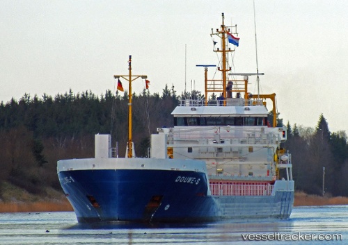
 Douwe s
Current Status
Where is the vessel?
Douwe s is currently in 14 nm SE of Selsey, based on AIS data received about 2h ago.
Latest AIS update:
Current position: 50.54507° N, 0.59396° W (14 nm SE of Selsey)
Average speed (last 7 days): Loading…
Average speed (last 30 days): Loading…
Vessel profile: Douwe s is a General Cargo Ship with dimensions 95m x 14m.
This page combines live AIS, route history, probable destination signals, nearby traffic, and port activity for practical vessel monitoring.
The current position of vessel Douwe s is 50.54507 lat / -0.59396 lng. Updated: 2026-03-28 08:18:20 UTCNearest reference points:
- 23 nm S of Ferring
- 15 nm S of Selsey
- Near CHICHESTER
Currently sailing under the flag of Netherlands ![]()
Douwe s built in 2011 year
Deadweight:
3637 tDetails:
Live Vessel Douwe s Analytics (details, animations, etc.)
Recent AIS points (UTC):
2026-03-28 03:38:38 UTC · 50.67072, 0.64046 · SOG 9.7 kn · COG 235°2026-03-28 05:24:10 UTC · 50.57332, 0.23436 · SOG 9.9 kn · COG 256°
2026-03-28 06:22:09 UTC · 50.54752, -0.03460 · SOG 13.1 kn · COG 269°
2026-03-28 08:18:20 UTC · 50.54507, -0.59396 · SOG 11.3 kn · COG 269°