 vesseltracker.com
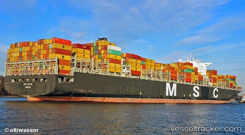
 Msc Katie
Current Status
Where is the vessel?
Msc Katie is currently in 15 nm N of Calais, based on AIS data received about 2h ago.
Latest AIS update:
Current position: 51.20623° N, 1.80012° E (15 nm N of Calais)
Average speed (last 7 days): Loading…
Average speed (last 30 days): Loading…
Vessel profile: Msc Katie is a Container Ship with dimensions 366m x 48m.
This page combines live AIS, route history, probable destination signals, nearby traffic, and port activity for practical vessel monitoring.
The current position of vessel Msc Katie is 51.20623 lat / 1.80012 lng. Updated: 2026-04-09 17:35:58 UTCNearest reference points:
- 14 nm SE of RAMSGATE
- 15 nm E of RAMSGATE
- Near Calais
Currently sailing under the flag of Panama ![]()
Msc Katie built in 2012 year
Deadweight:
139287 tDetails:
Live Vessel Msc Katie Analytics (details, animations, etc.)
Recent AIS points (UTC):
2026-04-09 11:49:22 UTC · 50.53148, 0.99953 · SOG 8.4 kn · COG 55°2026-04-09 13:24:02 UTC · 50.67635, 1.27593 · SOG 8.6 kn · COG 49°
2026-04-09 16:13:11 UTC · 51.03532, 1.56667 · SOG 9.8 kn · COG 48°
2026-04-09 17:35:58 UTC · 51.20623, 1.80012 · SOG 9.9 kn · COG 41°