 vesseltracker.com
 UKPIK
UKPIK
Current Status
Where is the vessel?
UKPIK is currently in 13 nm SW of Ile D’Ouessant, based on AIS data received less than 1h ago.
Latest AIS update:
Current position: 48.54694° N, 5.77097° W (13 nm SW of Ile D’Ouessant)
Average speed (last 7 days): Loading…
Average speed (last 30 days): Loading…
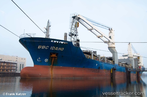
Vessel profile: UKPIK is a General Cargo with dimensions m x m.
This page combines live AIS, route history, probable destination signals, nearby traffic, and port activity for practical vessel monitoring.
The current position of vessel UKPIK is 48.54694 lat / -5.77097 lng. Updated: 2026-04-17 15:54:03 UTCNearest reference points:
- 16 nm NW of Ile D’Ouessant
- 35 nm SW of Ile D’Ouessant
- 18 nm NE of Ile D’Ouessant
Currently sailing under the flag of Netherlands ![]()
Details:
Live Vessel UKPIK Analytics (details, animations, etc.)
Recent AIS points (UTC):
2026-04-17 09:48:33 UTC · 47.28323, -6.74482 · SOG 12.5 kn · COG -1°2026-04-17 11:50:52 UTC · 47.69931, -6.48003 · SOG 14.1 kn · COG 29°
2026-04-17 13:29:58 UTC · 48.04028, -6.18096 · SOG 14.8 kn · COG 27°
2026-04-17 15:54:03 UTC · 48.54694, -5.77097 · SOG 14.1 kn · COG 20°